- April 21, 2022
- By Robert Herschbach
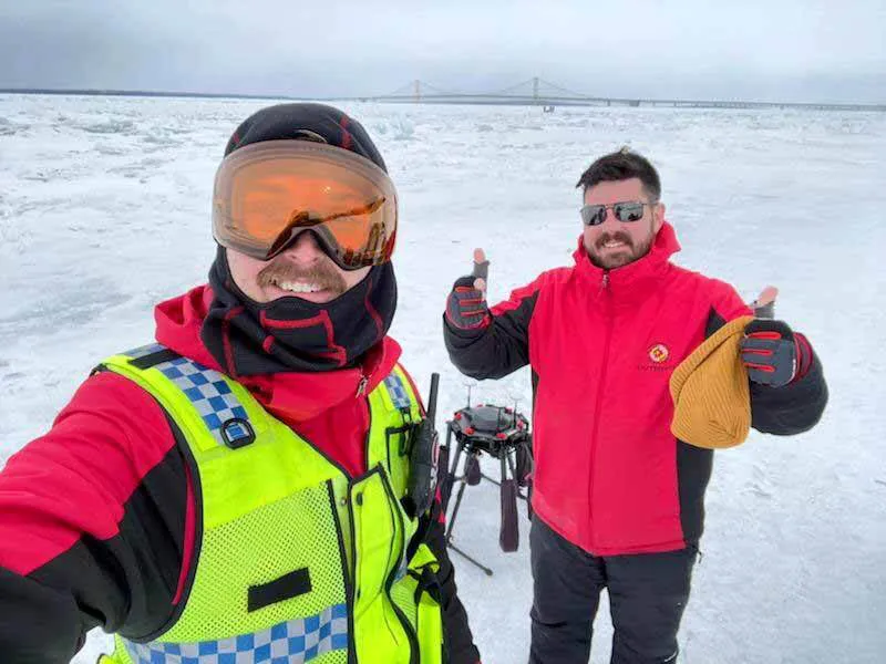
The temperature hovered in the teens, but to University of Maryland drone experts Darren Robey and engineer Grant Williams, the bone-chilling blast was perfect for testing not just their endurance, but that of the rotorcraft drone they were flying over a frozen Lake Michigan.
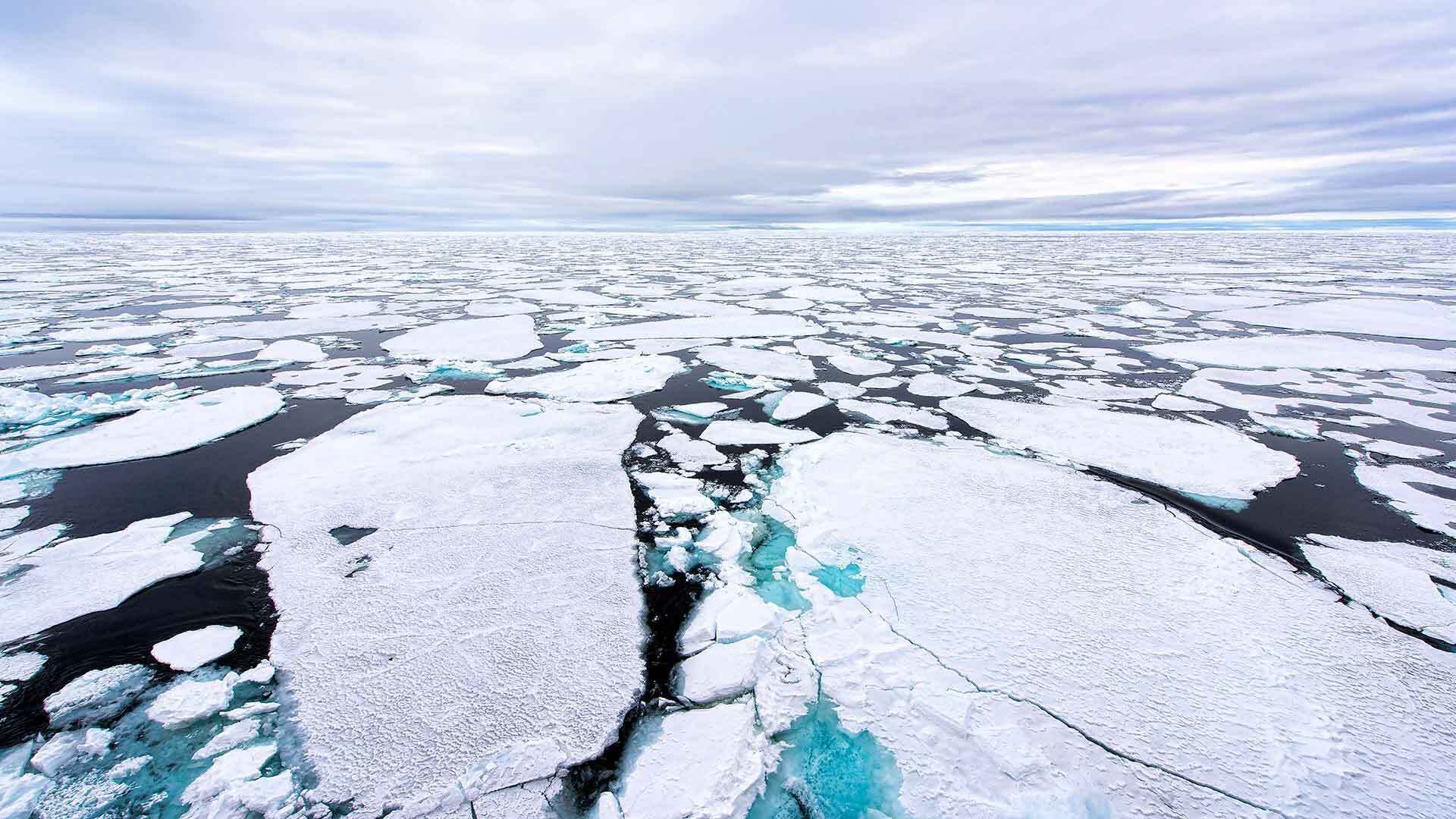
Robey, the chief pilot, and Williams, an engineer at the UMD Unmanned Aircraft Systems Test Site in St. Mary’s County, were there to help launch a system that could ultimately help the National Oceanic and Atmospheric Administration (NOAA) take better measurements of polar sea ice, as well as ice on the Great Lakes and other bodies of water. The technology could also provide crucial information to weather forecasters as well as help climatologists monitor earlier yearly melting of polar ice—a key gauge of climate change.
NOAA now uses satellite imagery to make such measurements. But in order to gauge accuracy, scientists must check it against data obtained at surface level. Until now, that meant sending teams out onto the ice to collect information in a process that’s costly, time-consuming and dangerous. Teams can find themselves stumbling over ice ridges or encountering areas that are simply impassable. In theory, drones could do the job more easily and quickly.
“Unmanned systems offer capabilities that just weren’t available before,” said NOAA principal investigator and scientist Sean Helfrich. “We’re hoping that by using such systems and equipping them with relatively low-priced cameras, we can get a valid estimation of what the satellite is seeing and how close that is to actual sea ice observations.”
Drones equipped with the right sensors can also capture information about ice properties such as reflectance, temperature, and how far the ice is protruding above the water line more readily than satellites. Such information can be crucial to understanding ice thickness and how difficult it might be for vessels to navigate around ice in the area.
“The integration of advanced sensors on small unmanned systems will enable a new wave of scientific capabilities and innovation that is only just beginning,” said Francis Padula, CEO of the company spearheading the testing, GeoThinkTank.
Outfitting Drones for Extremes
The idea sounds attractive, but to become a reality, NOAA first needs to ensure that drones can perform under extreme conditions. Although the tests in February weren’t quite held in Arctic-level conditions, they were close enough to show just how well an unmanned aircraft can withstand sub-freezing temperatures.
One key concern: protecting the sensors. The NOAA team was using a system known as MCAW, a six-channel multispectral camera plus an infrared one, together capable of providing information similar to that from a satellite, though at a far closer distance. But MCAW isn’t designed for temperatures below freezing, and the manufacturer no longer exists, making it difficult to replace parts or conduct repairs.
To keep the cameras safe and warm, UMD test engineer Josh Gaus had spent much of the previous weeks working to design and perfect a 3D-printed insulation system. Gaus knew that it not only had to be robust enough to protect the equipment, but also easy to install and remove.
“Out in the cold, you don’t want to have to fiddle with 15 tiny set screws so you can remove it in order to swap something out,” Gaus said. “We designed it so it can be removed easily by gloved hands. You just pull out a pin and the whole thing slides off the aircraft. It all stays insulated and protected.”
The insulation system engineered by Gaus, with technical support from GeoThinkTank, also helped keep the drone’s batteries from becoming too cold to perform adequately. This had been another major worry for the team going into the tests. As Robey explains, “they’re the crux of the operation. Without battery power, you’re stuck.”
Normally, the type of aircraft they were using could be expected to stay aloft 20 minutes while hauling a 15kg payload. But in sub-freezing temperatures, all bets were off. To ensure the drone could stay in the air, Robey and Williams in effect had to trick the batteries into believing the temperature was 45 degrees Fahrenheit, which the insulation system helped achieve.
“We wanted to be able to operate continually and not impede the data collection,” Robey said. “NOAA’s sensor and data analysts were out there on the ice with us, and their ability to do their work depended in turn on the reliability of our flight ops.”
Research aids climate science, weather forecasting
If the use of drones in the data validation process proves feasible in the long run, it could bring many benefits.
“Satellites provide some of our best tools for understanding how sea ice has changed over time,” Helfrich said. “These types of measurements do involve a level of uncertainty, however. By adding drones to the mix, we can quantify the errors.”
Meteorologists, meanwhile, rely on sea ice data in making their forecasts because conditions in the Arctic play a major role in weather conditions across the North American continent. With fine-tuned data available, weather forecasters may be able to better predict whether a coming weather system will yield the next Snowmageddon—or just a dusting.
Better measurements can also be a boon to native populations in the Arctic whose subsistence hunting depends on ice condition, and it can also aid commerce in the areas such as the Great Lakes regions in the United States, where critical supplies must be transported in and around the ice.
And while this round of tests was only a first step, it yielded the kinds of findings that NOAA needs to move forward—in no small part, Helfrich said, because of the capabilities demonstrated by the UMD UAS Test Site team.
”Their ability to understand what we needed was a huge strength,” he said. “It’s why were able to accomplish so much in so little time.”
Topics
Research